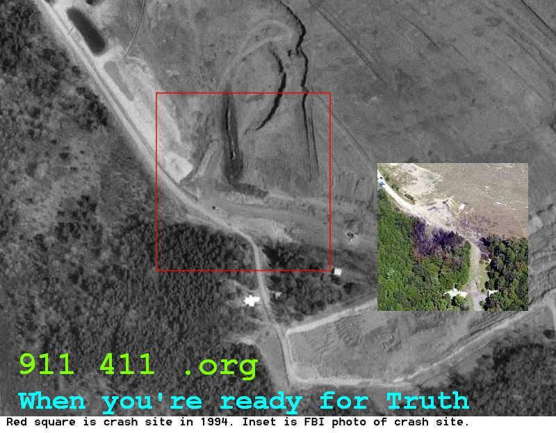
USGS aerial photos predating the manufactured event reveal horrible reality. Another aspect of Their Big Lie via Full Spectrum Information Dominance.
What’s available and how to get the USGS imagery:
Found
- NPS / FBI evidence / site galleries include aerial views and crash site photos. (National Park Service)
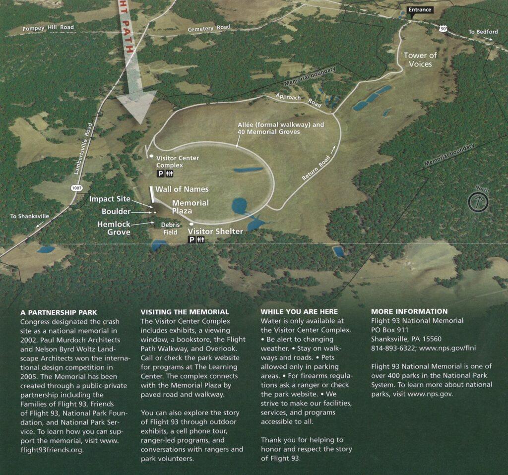
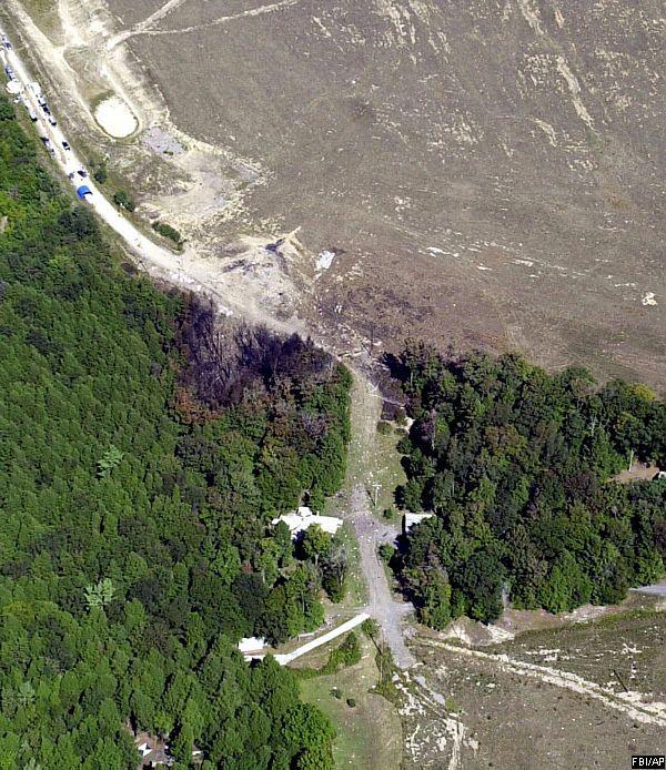
- The NPS site shows a labeled aerial map of the memorial / impact site.
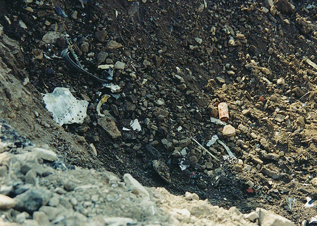
- The NPS Flight Data Recorder page includes a photo of the crater / debris near the impact site.
- Historical Pennsylvania aerial photo collections are catalogued via Pennsylvania Imagery Navigator / PennPilot (1937-present) (Penn State University Libraries Guides)
- USGS EarthExplorer is the portal to search for and download aerial photos / satellite imagery. (EarthExplorer)
- USGS’s Aerial Photo Mosaics (1937–1980) are another resource. (USGS)
How to get USGS / historical aerial imagery and convert to JPG
Step-by-step:
- Go to USGS EarthExplorer
Navigate to https://earthexplorer.usgs.gov/ (EarthExplorer) - Define the location / bounding box
Use known coordinates near the crash site (for example ~ 40.05195, –78.90395) or draw a polygon around the site. - Select data sets
Choose relevant data sets such as “Aerial Imagery,” “High Altitude Photograph,” “USGS Aerial Photo Mosaics,” or “DigitalGlobe / Satellite Imagery.” - Specify date ranges
To get historical (pre-2001) and post-2001 images, set date filters accordingly. - Browse results & download
Many of the images will be in TIFF or other formats. You might need to “order” or download the files depending on availability. - Convert to JPG
Once you have the image in TIFF (or other high-quality raster) you can convert to JPG using:
- GIS software (QGIS, ArcGIS)
- Image conversion tools (e.g. GDAL:
gdal_translate input.tif output.jpg) - Photo editors (Photoshop, GIMP)
Be careful with compression—keep quality high if you want to preserve detail.
- Overlay / align with known maps or NPS photos
Use the site maps or NPS aerials as a reference to align the imagery.
An excellent article (and series of smart articles by another apparently genuine truth-seeker, as indicated solely by dogged pursuit and long-spewed articles and tidbits of verifiable truth) on the Shanksville mind-shank —- https://911revision.substack.com/p/hoodwinked-at-shanksville-on-911